The project aims to limit the continued urban sprawl in the ecological mountain reserve of Jaipur. It proposes to create a resilient hillside flood prevention system that provides the framework for further fortification of adjacent neighborhoods and curates an ecological buffer that becomes an urban asset.

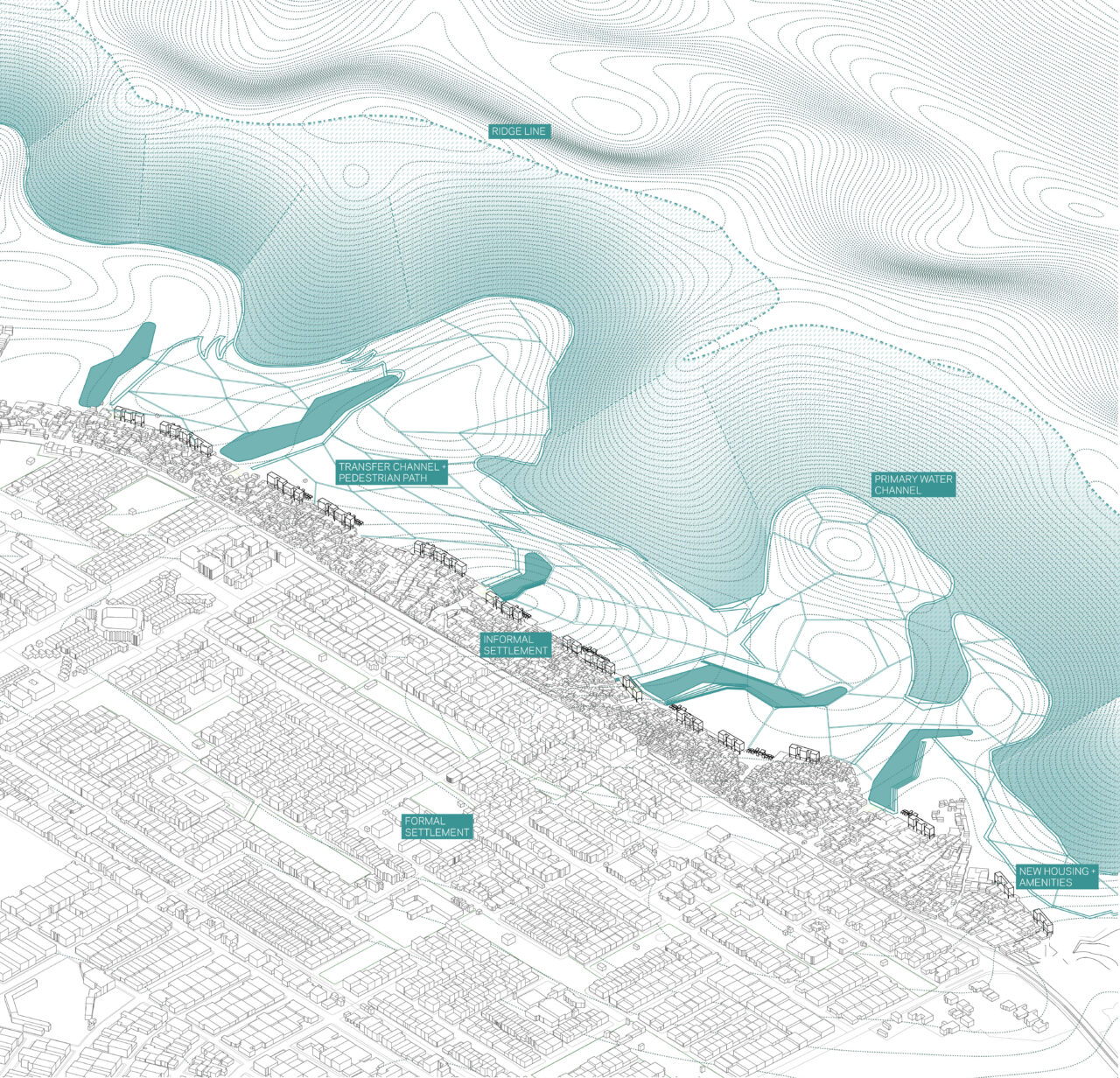
AXONOMETRIC VIEW OF JAWAHAR NAGAR
The project inscribes a line along the mountain range on the north eastern edge of Jaipur. Primarily a method of rainwater collection and harvesting from the slopes of the mountain, as was conceived by the engineers of the Nahargarh Fort, the project embeds public infrastructure into this new edge, that also serves to limit the sprawl of the city into the ecological mountain reserve. This infrastructure includes public restrooms, trash recycling centers, livestock pens along with new housing, community and educational amenities. Decentralized sewage treatment plants along with bio-remediation measures are combined to clean the wastewater generated from the informal neighborhood at the edge before it collects into the lakes at the foot of the mountains, cleaning the lakes in the process. This ecological buffer zone is designed and envisioned as a public amenity for the future citizens of Jaipur while also acting as a flood protection mechanism.

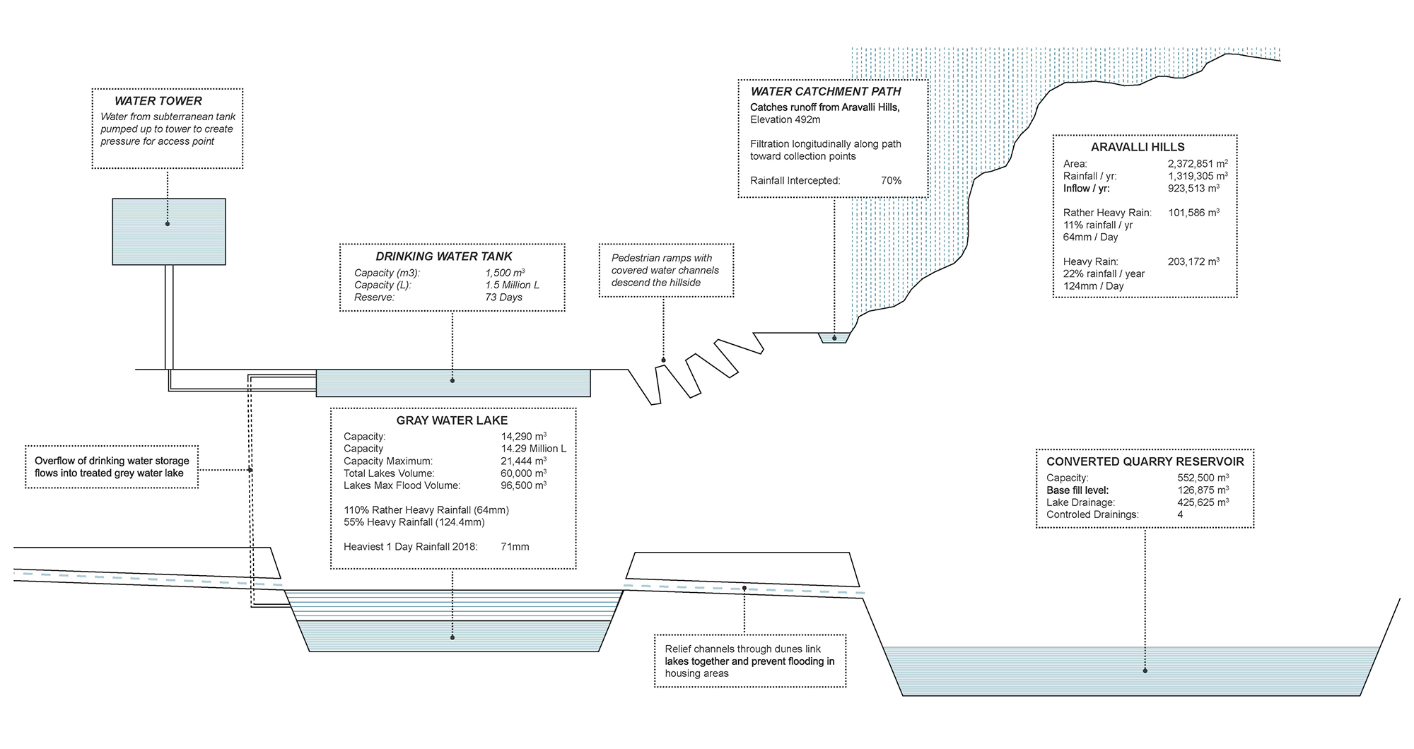
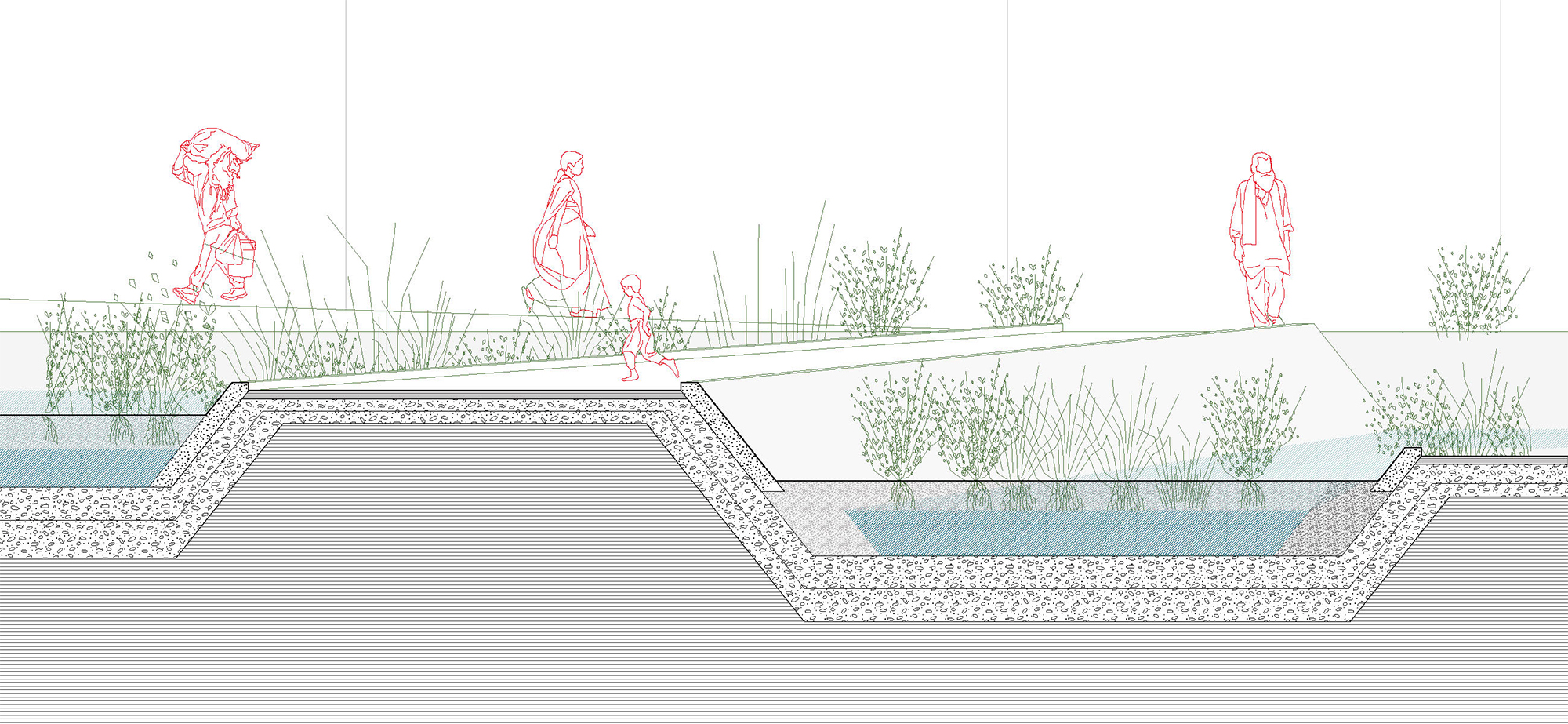
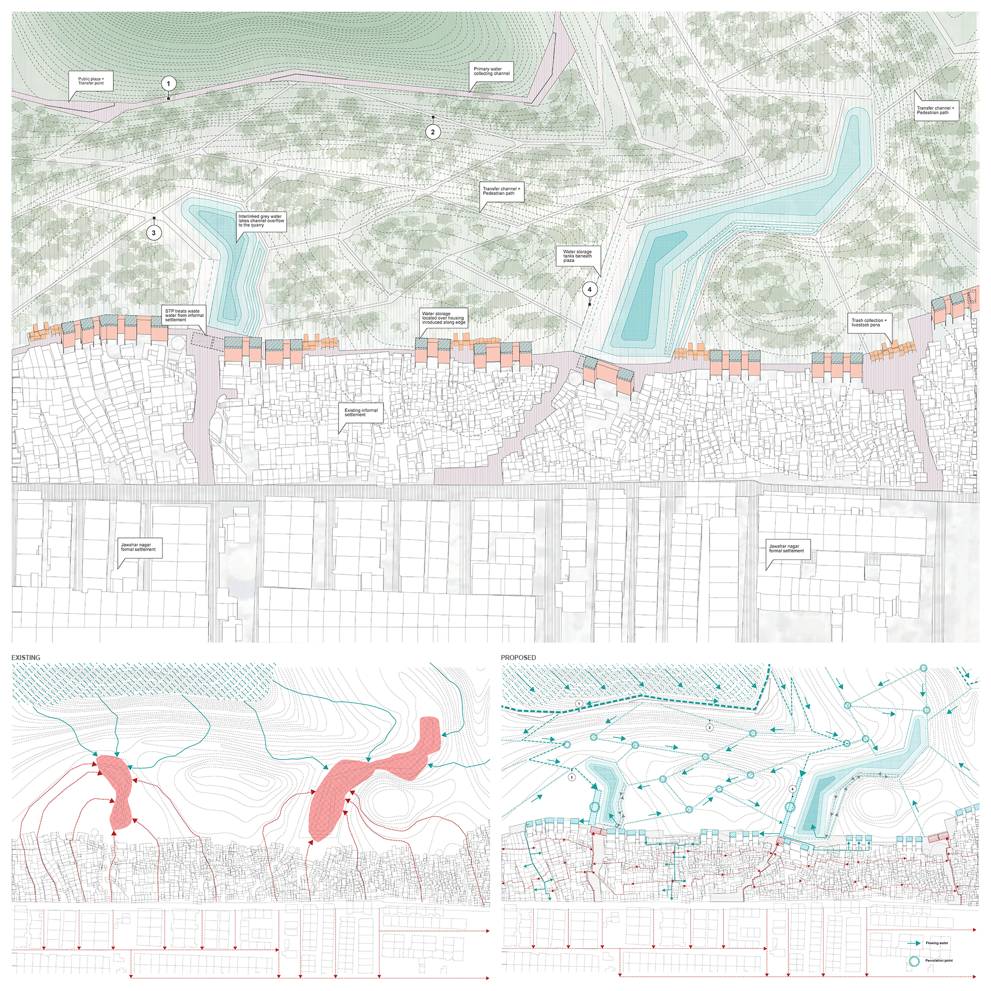
The Primary water collection channel doubles as a walking path running along the edge of the mountains, interspersed with resting spots where transfer channels descending the mountain side emerge and divert the water towards the lakes. The transfer channels comprise of infiltration blocks that allow water to percolate, while excess water flows towards the storage, and double up as walking/ biking paths. The transfer channels are punctuated by percolation points where surface runoff is allowed to percolate to the ground or flow towards the underground storage tanks located at the base near the lakes.


Wastewater from informal settlements at the edge of the city is directed through decentralized sewage treatment plants and bio remediation before being released into the lakes.


EXISITNG VERSUS PROPOSED DIAGRAM FOR WATER MANAGEMENT


