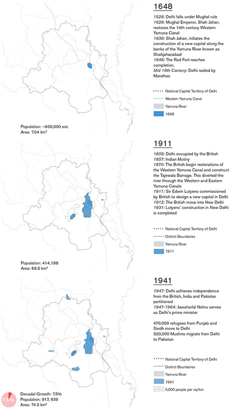
Utilizing remote sensing and LANDSAT satellite observations of land cover, data is obtained in order to determine how human populations within the New Delhi region have expanded and how land use has changed over the last decades. This information is critical for future urban planning and hydrological modeling efforts of the Yamuna River System. Over the past decades, Delhi and its surrounding territory have undergone immense vegetation loss in conjunction with exponential growth in agricultural and urban areas. This growth increases pollution levels and presents an issue of wastewater runoff during the monsoon season which is harmful to the entire Yamuna region. These images reveal a dangerous future for Delhi with certain districts seeing over 20% loss in vegetation cover. They also show little results from environmental efforts to increase vegetation. If this trend continues, and Delhi is to urbanize further without environmental considerations, the pollution and runoff into the Yamuna is only likely to worsen. The dramatic changes of land cover over the past 25 years illustrates just how vital it is that exponential expansion be addressed holistically by designers, government authorities, and society as a whole.

Matt Reidenbach, Assistant Professor of Environmental Sciences


