Several modes of transportation use the streets, with no division between car, bike, and pedestrian pathways. At intermodal points, one can access all public transportation and several lanes of cars crossing at once.

Along the drain, there are different street conditions depending on the density and population.


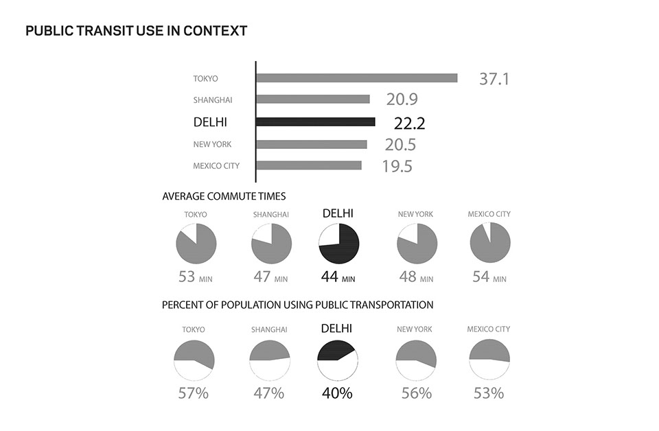
Commuters in Delhi travel an average of 44 minutes each day, which is similar to other cities around the world. However, about 33% of people walk, 27% drive a private vehicle, and 44% use public transportation. Most of this is influenced by which areas of the city have access to public transportation. The most often used form of public transportation is the bus.

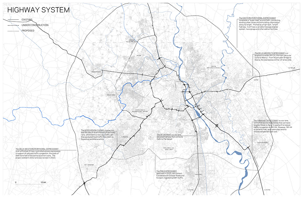
The pattern for Delhi’s highway development is consistent with the traffic systems of other large scale contemporary cities, consisting of concentric ring roads, intersected by radial roads bringing traffic into the city. It both influences and follows the city’s urban development, as evident by Faridabad and Gurgaon, both former villages that are now suburban extensions of the Delhi metropolis.

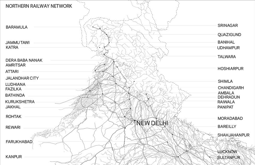
Extended Rail Network on the Indian Subcontinent.

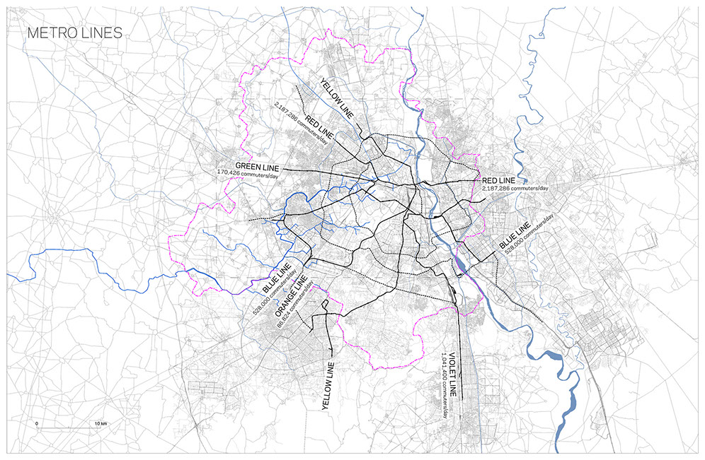
Delhi’s metro system is the most efficient form of transportation. It serves to people commuting outside of Delhi into the center for work as well as various nodes across Delhi. Most commuters come from NW and NE of Delhi, with 2 million riders per day on average. Delhi’s metro system creates a polycentric character across the city where accessible transportation is concentrated in nodes are various parts of the city, while other areas are inaccessible.

Delhi’s Metro System, Urban Scale.

Metro Traffic Density of Ring and Commuter Rails, Regional Scale.

Traffic Density Nodes, Urban Scale.


